Wednesday, March 28, 2007

La Jolla

La Jolla is one of the most picturesque towns in San Diego County. We spent only one day cruising the place and didn’t cover a tenth of the hottest photo spots. This is a shot from the largest of its beaches.

La Jolla draws an eclectic, but well to do, crowd. They surf…


and they sunbathe…


…and sunbathe some more…


…and do artsy things…


They play golf…….here at Torrey Pines Municipal Golf Course, home to the Buick Invitational and the 2008 US Open. This shot looks down the fairway of number one on the South Course.

Sometimes they fling themselves off a 300 foot cliff at the La Jolla Glider Port…


But mostly they just enjoy their little corner of heaven with great views, good restaurants, and plenty of money to spend. By the way, every significant stock trading house had a big plush office within two blocks of where I took this picture.

This edition was created and published in Nevada. Although I really enjoyed the two weeks we spent in San Diego County, I must say that I am happy to be out of the ever present traffic.

Monday, March 26, 2007

San Diego County

I have decided that here in Southern California the term “rush hour” is completely inaccurate and should be changed to “crawl hour”. However, if you get past the massive traffic snarls, higher prices on everything, waiting in line most places you go, and hearing other than English spoken by seemingly half the people……then wow, what a wonderful place. The weather is great, no hurricanes or tornadoes, rarely a thunderstorm, and the scenery, well it is gorgeous.

Southern California is overloaded with things of beauty, and I’m not speaking just of the girls at Hooters (although that is definitely a great spot for sightseeing). As a for instance, how about the Mission San Diego de Alcala. This is California’s first church and was founded in 1769. It is the first of a chain of 21 missions that stretch northward along the California coast.

Possibly the most amazing spot in San Diego County is Balboa Park. In 1868 1,400 acres was set aside for a city park (almost an acre apiece for every adult resident). The park has become home to the world renowned San Diego Zoo, athletic fields, a golf course, and beautiful buildings and museums in an eclectic Spanish Revival style. Here is the Museum of Man, an example of the most common style.

This is the Natural History Museum, another eye treat. Many of the buildings in the park were constructed to accommodate international expositions between 1915 and 1936. Their popularity has been credited with inspiring the Spanish motif so popular throughout Southern California.

Here is another World famous spot, the housing of the Hale telescope on the grounds of the Palomar Observatory. At the time the 200 inch Hale reflector telescope went into use (I think it was the late 40’s or early 50’s) it was the World’s largest. Now, although still providing excellent views of other worldly spots, it is not even in competition for the number one spot any longer.

How about a tar pit, I mean famous ones like those that surround the Page Museum at the La Brea Tar Pits. The Museum claims to house the richest and most important collection of Ice Age fossils. No dinosaurs here, they were long dead before the last ice age. Animals became stuck in the seeping asphalt form 12 to 40 thousand years ago. It is the home to the likes of Sabertoothed Cats (not tiger), Dire Wolfs, American Lions, American Mastodon, and many more animals and birds. By the way, the tar pits are in Los Angeles, so I strayed outside of San Diego County a bit.

Monday, March 19, 2007

Point Loma – Cabrillo National Monument

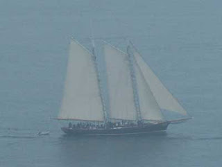
It is noon and we’ve been waiting 2 hours for the fog to dissipate. If we stay here on Point Loma for a few more hours, some 400 plus feet above San Diego Harbor, maybe it will lift. But we have places to go and pictures to take. I guess we’ll just have to settle for what is in range of my telescopic lens, while occluded by fog. Like this schooner taking a group out on a tour.

Here stands Juan Rodriquez Cabrillo, first European to explore the West Coast of what later became California. He made a landing somewhere in San Diego Harbor in 1542 and died only months later (at age 44) from an infection following a fall that left him with a compound fracture of the arm. Born in Spain or Portugal, he was raised in Cuba and lived during the “Age of the Conquistadors”. He participated in the conquering of the capital city of the Aztec’s under direction of Hernando Cortez, but is remembered by Californians for discovering San Diego Harbor.

A lighthouse shares the point with Cabrillo. Once called the “Star of the Silver Gate”, the lighthouse sits on the highest ground on Point Loma at 422 feet. Construction began in early 1854 and the lighthouse was in continuous operation from 1855 to 1891.

What’s this? Your guess is???? Well, the truth is that it is the spiral staircase that leads to the lens room at the top of the tower, looking down from the top.

I think this picture is the highlight of the day, taken thru the fog inside the Fort Rosecrans National Cemetery. The cemetery sits inside the Fort Rosecrans Military Reservation (navy and marine I think). Passing through the Fort is the only access to Point Loma, and the cemetery was a surprise treat. Do I sound a little too “happy”, well I had to concentrate on the beauty of the grounds and not how it got filled. Didn’t want to spend the rest of the day in a gloomy mood.

The day before this was spent at the San Diego Zoo, touted by some as one of the top three zoo’s in the world. I posted a blog for it at the same time as I posted this one, so the Zoo was stuck into the archive. You can get to it using the archive section at the top left of this page.

Sunday, March 18, 2007

San Diego Zoo

It was hard to pick the pictures for the blog out of the 200 I took, but here are my choices. There was one more, female chimpanzee, but she was topless, and well…….stacked. I didn’t want such a picture to cause my blog to be rated “R” and thereby have a restricted readership. So, I kept her picture for my personal enjoyment, leaving you all to use your imaginations.

These pictures don’t require a story, so you get to look at them free of my normal line of chatter. Enjoy……


Now ain't they just the cutest things........

Saturday, March 17, 2007

Yuma, Arizona

Thanks Yuma! I have found that is what we all should be saying, that is if you like a good salad….

Hundreds of years ago Yuma was one of the few places along the Colorado River where a crossing could be made with relative safety. The river, which could be as wide as 15 miles during spring runoff (from the North), narrowed to 400 yards between two granite outcroppings. This made it the gateway to California and Mexico and the point was named “Yuma Crossing” after the Indians native to the area. This crossing was important as far back as 1540 when the first Spanish explorers came North out of Mexico.

Yuma was an access point for seekers of the gold discovered in California and also the hordes of others seeking other forms of fortune in Southern California, the land of milk and honey. It was the home of the Yuma Territorial Prison which, between 1876 and 1909, housed Arizona’s most dangerous and notorious criminals. It residents were infamous enough to have been made the center figures of many books, movies and TV shows. Believe me, during the summer months that prison must have been as close to a sentence in hell as a living man could be given.

Today Yuma is the home of the Yuma Proving Grounds, for the desert testing of military equipment. It is only a few miles from the Imperial Dunes in California, a vast series of sand dunes where people play and where a sequence from Stars Wars was filmed. It is the gateway (via Interstate 8) to Southern California and parts of Mexico.

However, for us veggie lovers, the most important point in Yuma’s history may have occurred in 1912 when the Yuma Siphon was opened. The siphon is an underground U-shaped canal that carries irrigation water under the Colorado River. At the time it was an impossible engineering feat, but they built it anyway. Vertical tunnels on either side of the river go down over 100 feet to bedrock. A horizontal tunnel joins the two through more than 400 yards of bedrock. This is no small canal either, dozens of men worked in the tunnels at the same time.

Now back to the salads. The Yuma valley is fertile (from thousands of years as a flood plane), but dry. The irrigation water coming through the siphon allowed the valley to bloom. One of the primary crops is now lettuce. And there you go, salads for you and me. The lettuce (and several other veggies like cauliflower, broccoli, cabbage, etc.) is hand picked and processed primarily by Mexican laborers (be careful George, send ‘em home and we may all have to give up salads).

There are undoubtedly many companies distributing the veggies out of this desert oasis. Foxy is one I recognize as is Fresh Express, with a processing plant only about two miles from where I am staying (so they get to be “featured” with a picture of their plant). By the way, it is too hot to grow veggies in the summer so they switch over to cotton, making use of the land year round.

Here's a cauliflower for you. So, “Thanks Yuma”, and pass the Newman’s Own Balsamic Vinaigrette and some of those blue cheese crumbles.

Wednesday, March 7, 2007

Chiricahua National Monument & Kitt Peak National Observatory


Here, for the nominal cost of achy knees and sore feet, I present to you the Chiricahua National Monument. This area was once referred to, by the Chiricahua Apache Indians, as the “Land of Standing Up Rocks”. The Apaches were believed to have been in the area nearly 100 years before Columbus made his first visit. Cochise and Geronimo roamed throughout the surrounding area, resisting the tide of the American pioneers. The Apaches’ resistance to foreign invaders had been going on since the Spanish first showed up in the 1500’s. The Chiricahua finally surrendered in 1886 and were ultimately resettled on reservations in New Mexico and Oklahoma.

The National Monument status was granted in 1924. However, the formations began 27 million years ago following massive volcanic eruptions which deposited ash thousands of feet thick and covering more than 1,200 square miles. A few (million) years later, following major uplifts and significant erosion, the formations took shape. And what amazing shapes they took.

Ja Hu Stafford and his young wife Pauline (I don’t know if young means 12 or 20) built this cabin in 1880. They were some of the early settlers and were probably lucky to have survived the Apaches. In 1888 they were joined by the Erickson’s, a Swedish immigrant couple. By 1917, the Erickson children had bought out the Stafford children and turned the working cattle ranch into a guest ranch (which entertained guests until 1973).

The Erickson's called the ranch "Faraway Ranch", and for good reason, it was far away from everything (and still is). This triangle probably is not the one that called guests to dinner, but it does frame one of the great views from the ranch house. And now on to
.
.
.
.
Kitt Peak National Observatory

Located atop the 6,875 feet high Kitt Peak, above the Sonoran Desert and only 60 miles from downtown Tucson, sits Kitt Peak National Observatory. It is home to a collection of 23 optical telescopes and 2 radio telescopes. The largest of the optical telescopes has a focusing mirror over 8 meters across (more than 25 feet) and the cradle weighs over 275 tons (be warned, I am recalling that from memory…).

One of those 23 is a telescopes designed for solar observation. It is actually 3 telescopes in one building and at one time they were the three largest solar telescopes in the world. The largest of the 3 is still the world’s largest but the two smaller telescopes have lost their 2nd and 3rd place. A most amazing structure, it stands over 100 feet tall and that angled shaft on the right goes more than 200 feet deep into the mountain. It does its magic with mirrors (no smoke, that would reduce the clarity of the images it produces) as do all the optical telescopes on the peak.

The solar telescope was in use by a group from Goddard Space Center during our visit. The bearded gentleman came out and explained to us what they were attempting to do. He said they were having trouble adjusting their instrumentation to work correctly with the telescope. He implied the final adjustment might be made with one of the boots he was currently wearing (a form of correction to pesky electronic equipment I was familiar with). The rest of what he said about their experiment went right over my head.